Mapping of Cahokia will be Largest Project of its Kind in all the Americas
Associate Professor of Anthropology Casey Barrier and colleagues Ed Henry of Colorado State University, Robin Beck of the University of Michigan, and Tim Horsley of Horsley Archaeological Prospection, have received a five-year $312,000.00 grant from the National Science Foundation to conduct the largest archaeo-geophysical project to date in all the Americas.
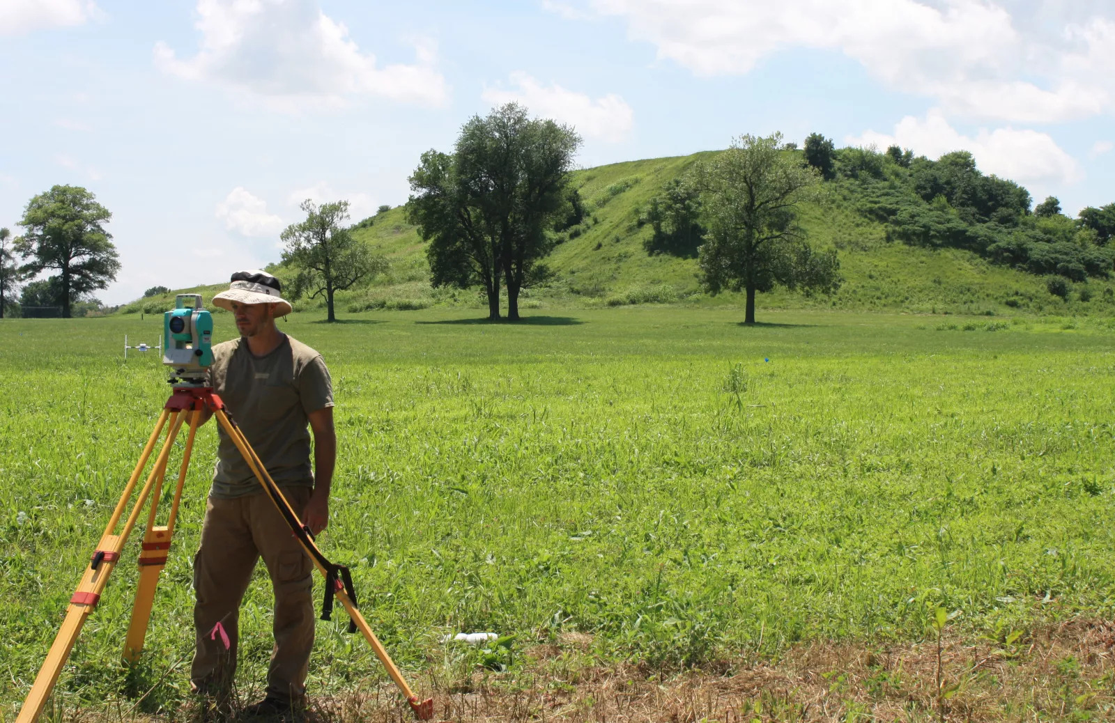
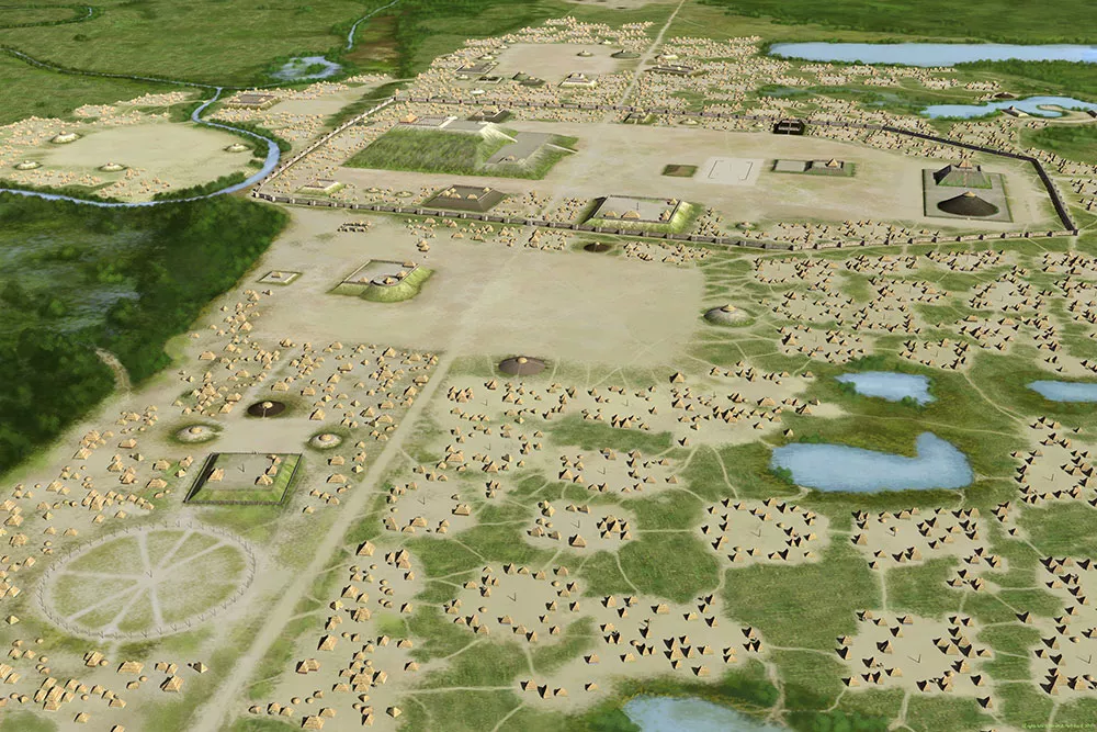
Barrier and his colleagues will use advanced magnetometry equipment to develop the most comprehensive map ever of the city of Cahokia, located in modern-day Illinois across the Mississippi River from St. Louis, Missouri. For this project they will focus on an area of approximately 5.5 square kilometers centered on “downtown Cahokia” that was home to as many as 10,000 to 15,000 residents during a period of rapid growth during the 10th and 11th centuries CE.
“You can think of it as an X-ray image of what’s preserved under the surface,” says Barrier of the research. “So, in terms of preservation of the site, we won’t put a shovel or a trowel into the ground. Yet, the research will provide important information about how humans organized themselves in early cities. And Cahokia is one of a handful of places across the globe where humans initiated urban life without direct contact with other urban societies.”
Using their equipment, the researchers will be able to identify buried house foundations, storage or refuse bins, and other modifications to the landscape like the production of plazas.
“Long after the wooden superstructure and roof has decayed or been taken down, magnetometry can detect the foundations of buildings and houses,” Barrier explains.
Barrier has been conducting research in the region since 2011, when he was writing his Ph.D. dissertation, and some of his colleagues have been studying the area for even longer. The current team of researchers began working at Cahokia together in 2016.
One of the key differences between this new project and their previous work will be the equipment they’re using and the scale at which it allows them to operate.
In the past, Barrier and his colleagues have used simple dual-sensor magnetometers to examine smaller areas. The devices look like pieces of PVC pipe fashioned together in an H-shape. The “legs” of the devices are around 3 feet long with sensors on the tops and bottoms. The researcher using the device holds onto the crossbar, which has controls in the center, and slowly paces the area being examined to collect data. The researchers would work in 30x30 meter grids and slowly follow rope markers.
For this project, the researchers will be using two souped-up versions of these devices with 16 sensors that can be towed by all-terrain vehicles and cover much larger areas more quickly and accurately. The devices will also be outfitted with GPS sensors, eliminating the need for creating and moving physical grid lines.
“Every second, the machine is going to know where it is with sub-centimeter accuracy, so we can cover a lot of ground really quickly.”
Survey work will be done in both the winter and summer and will begin in May of 2023.
Joining the researchers in the field and the lab will be students from each institution involved in the project. Barrier will hire two anthropology majors to work in this lab for the next two academic years and he hopes a few students will have the opportunity to travel to the Cahokia site and engage in field work.
“The students will be working right alongside us in the lab to digitize and interpret our geophysical data as it’s coming in. It’s great to be at a place like Bryn Mawr where I can offer this kind of opportunity to our undergraduates.”
Since they started this project, the researchers have been building relationships with several descendant tribal nations and have designed the project to ensure tribal access to all collected data. The University of Michigan has provided additional funding that will allow the researchers to support representatives of the ancestral nations to meet with them at the site early in the project.
“Working together is an important part of research. It’s important to us that Indigenous groups have a central role in preservation and education at Cahokia and these data will provide a valuable resource.”
After the project, the data will be made available to other scholars and students via the Digital Archaeological Record and a web portal hosted by the University of Michigan. The digital atlas will become the basis for future understandings of early North American urbanism at Cahokia, forming a foundation for multi-year research projects, Ph.D. dissertations, and M.A. theses, and even projects through which students can learn GIS techniques while exploring America’s first city.